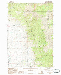
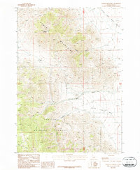
1987 Map of Bell Mountain
USGS Topo · Published 1987About this map
Bell Mountain and Foss Mountain dominate this high-altitude landscape along the border of Challis National Forest and Targhee National Forest. The map documents a rugged transition between the Lemhi and Butte county lines, where human activity is sparse but specialized. In the southwestern corner, the small settlement of Clyde sits near the Little Lost River, which is monitored by a Gaging Sta.
Find a feature on this map
27 named features on this map. Tap any name to fly to it.
Don’t see what you’re looking for? This feature index may not catch every label — zoom into the map to look around manually.
Map Details
Editions of this 1987 Bell Mountain Map
This is the sole edition of this map. No revisions or reprints were ever made.
Other maps of this area

1955 · Dubois
USGS Topo · 1:250,000

1956 · Nicholia
USGS Topo · 1:62,500

1957 · Diamond Peak
USGS Topo · 1:62,500

1957 · Gilmore
USGS Topo · 1:62,500

1957 · Hawley Mountain
USGS Topo · 1:62,500

1958 · Dubois
USGS Topo · 1:250,000
1987 · Fallert Springs
USGS Topo · 1:24,000
1987 · Mulkey Bar
USGS Topo · 1:24,000
1987 · Nicholia
USGS Topo · 1:24,000
1987 · Hawley Mountain
USGS Topo · 1:24,000