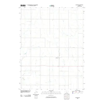
2009 Map of Bellaire
USGS Topo · Published 2009About this map
The settlement of Bellaire serves as the focal point of this Smith County survey, situated at the junction of State Hwy 182 and several rural thoroughfares. The landscape is defined by an intricate network of waterways that drain the agricultural plains, including the headwaters of West Oak Creek, Middle Oak Creek, and the curiously named Monkey Run. These streams provide a clear indication of the local topography and drainage patterns common to this part of Kansas.
Find a feature on this map
10 named features on this map. Tap any name to fly to it.
Don’t see what you’re looking for? This feature index may not catch every label — zoom into the map to look around manually.
Map Details
Editions of this 2009 Bellaire Map
This is the sole edition of this map. No revisions or reprints were ever made.
Other maps of this area

1893 · Smith Center
USGS Topo · 1:125,000

1955 · Beloit
USGS Topo · 1:250,000

1959 · Beloit
USGS Topo · 1:250,000
1973 · Portis NE
USGS Topo · 1:24,000
1973 · Cora
USGS Topo · 1:24,000
1973 · Reamsville
USGS Topo · 1:24,000
1973 · Smith Center
USGS Topo · 1:24,000
1973 · Mc Cracken Branch
USGS Topo · 1:24,000
1973 · Lebanon
USGS Topo · 1:24,000
1973 · Portis NW
USGS Topo · 1:24,000