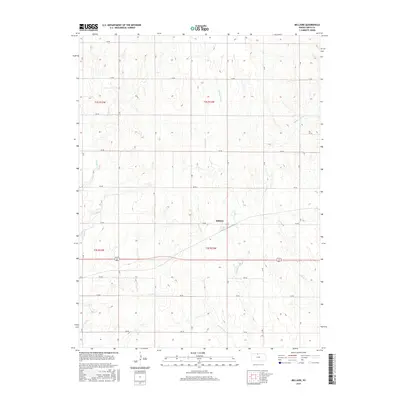
2015 Map of Bellaire
USGS Topo · Published 2015About this map
Bellaire occupies a central position in this portion of Smith County, situated along the path of Highway 281. The landscape is defined by the headwaters and drainages of several local waterways, including the curiously named Monkey Run and the branching reaches of W Oak Cr and Middle Oak Cr. This 2015 survey illustrates a highly structured agrarian environment, where the terrain is partitioned by a meticulous grid of rural routes such as 150 RD and V RD. The drainage patterns of Spring Cr and Frog Cr reveal the subtle elevation shifts that dictate the agricultural layout of the region. This map provides a clear view of the modern rural infrastructure, showing how contemporary road designations and township boundaries like t3s r12w continue to follow the historical Public Land Survey System framework.
Find a feature on this map
28 named features on this map. Tap any name to fly to it.
Don’t see what you’re looking for? This feature index may not catch every label — zoom into the map to look around manually.
Map Details
Editions of this 2015 Bellaire Map
This is the sole edition of this map. No revisions or reprints were ever made.
Other maps of this area

1893 · Smith Center
USGS Topo · 1:125,000

1955 · Beloit
USGS Topo · 1:250,000

1959 · Beloit
USGS Topo · 1:250,000
1973 · Portis NE
USGS Topo · 1:24,000
1973 · Cora
USGS Topo · 1:24,000
1973 · Reamsville
USGS Topo · 1:24,000
1973 · Smith Center
USGS Topo · 1:24,000
1973 · Mc Cracken Branch
USGS Topo · 1:24,000
1973 · Lebanon
USGS Topo · 1:24,000
1973 · Portis NW
USGS Topo · 1:24,000