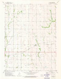
1973 Map of Bellaire
USGS Topo · Published 1975About this map
The small settlement of Bellaire sits at the heart of this Smith County landscape, serving as a focal point for the surrounding agricultural townships of Washington, Cora, Center, and Blaine. This 1970s survey captures a rural Kansas community defined by its relationship with the Chicago Rock Island and Pacific railroad, which cuts diagonally across the prairie. The map reveals a highly structured grid of section lines and rural roads, interspersed with family-oriented landmarks like Dewey Ch.
Find a feature on this map
14 named features on this map. Tap any name to fly to it.
Don’t see what you’re looking for? This feature index may not catch every label — zoom into the map to look around manually.
Map Details
Editions of this 1973 Bellaire Map
This is the sole edition of this map. No revisions or reprints were ever made.
Other maps of this area

1893 · Smith Center
USGS Topo · 1:125,000

1955 · Beloit
USGS Topo · 1:250,000

1959 · Beloit
USGS Topo · 1:250,000
1973 · Portis NE
USGS Topo · 1:24,000
1973 · Cora
USGS Topo · 1:24,000
1973 · Reamsville
USGS Topo · 1:24,000
1973 · Smith Center
USGS Topo · 1:24,000
1973 · Mc Cracken Branch
USGS Topo · 1:24,000
1973 · Lebanon
USGS Topo · 1:24,000
1973 · Portis NW
USGS Topo · 1:24,000