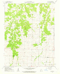
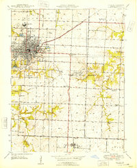
1962 Map of Bellamy
USGS Topo · Published 1963About this map
Bellamy and Rousertown anchor this rural landscape in the early 1960s, situated along the border of Vernon and Barton counties. The terrain is defined by the winding course of Clear Creek and its tributaries, including Walnut Creek and McCarty Creek. Local history is deeply embedded in the land through numerous small burial grounds and parish sites, such as the Olive Branch Cemetery and the nearby Olive Branch Church. The presence of a Strip Mine and scattered Gravel Pits indicates the local extraction industry at mid-century. Further south, the rural character continues with Dunnegan Grove Church and the St James Church near the southern boundary. This survey provides a clear view of the dispersed farmsteads and township lines that structured life in this portion of western Missouri before significant modern development altered the rural road network.
Find a feature on this map
21 named features on this map. Tap any name to fly to it.
Don’t see what you’re looking for? This feature index may not catch every label — zoom into the map to look around manually.
Map Details
Editions of this 1962 Bellamy Map
2 editions found
Other maps of this area

1886 · Nevada
USGS Topo · 1:125,000

1894 · Nevada
USGS Topo · 1:125,000

1933 · Camp Clark
USGS Topo · 1:24,000

1939 · Dederick
USGS Topo · 1:24,000

1939 · Eldorado Springs South
USGS Topo · 1:24,000
1942 · Dederick
USGS Topo · 1:24,000
1942 · Eldorado Springs South
USGS Topo · 1:24,000

1947 · Joplin
USGS Topo · 1:250,000
1948 · Nevada
USGS Topo · 1:24,000

1949 · Joplin
USGS Topo · 1:250,000