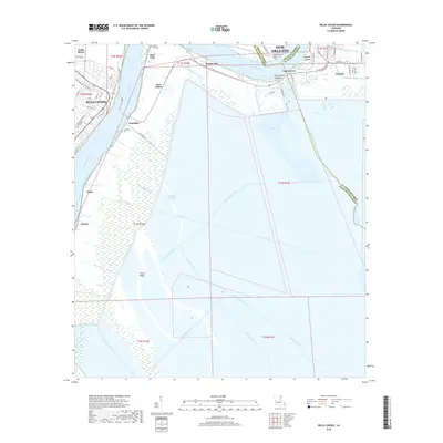
2018 Map of Belle Chasse
USGS Topo · Published 2018About this map
Belle Chasse sits along a sharp bend of the Mississippi River, serving as a focal point for the complex intersection of river-dependent industry and swamp drainage south of New Orleans. The map documents the intricate canal systems that define the low-lying terrain of Plaquemines and St. Bernard Parishes, including the Braithwaite Canal, Forty Arpent Canal, and the long reach of Bayou Mandeville. Evidence of the region's hydraulic history is visible in features like the Caernarvon Crevasse and Poydras Crevasse, marking locations of significant levee breaches. Small riverfront communities such as Scarsdale, Stella, and Braithwaite are linked by the Belle Chasse Ferry, while interior features like Big Mar and Tigers Ridge reflect the transitional landscape between the river levees and the coastal marsh.
Find a feature on this map
72 named features on this map. Tap any name to fly to it.
Don’t see what you’re looking for? This feature index may not catch every label — zoom into the map to look around manually.
Map Details
Editions of this 2018 Belle Chasse Map
This is the sole edition of this map. No revisions or reprints were ever made.
Other maps of this area

1891 · Pointe a La Hache
USGS Topo · 1:62,500

1891 · New Orleans
USGS Topo · 1:62,500

1892 · Barataria
USGS Topo · 1:62,500

1892 · St. Bernard
USGS Topo · 1:62,500

1892 · Pointe a La Hache
USGS Topo · 1:62,500

1932 · New Orleans NE
USGS Topo · 1:31,680

1932 · New Orleans SE
USGS Topo · 1:31,680

1935 · Delacroix
USGS Topo · 1:31,680

1935 · Lake Batola
USGS Topo · 1:31,680
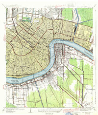
1939 · New Orleans East
USGS Topo · 1:31,680