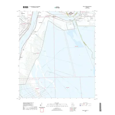
2020 Map of Belle Chasse
USGS Topo · Published 2020About this map
The Mississippi River defines the western edge of this landscape at Twelvemile Point, where the low-lying terrain of Plaquemines and St. Bernard Parishes meets a complex network of drainage and industrial waterways. Settled areas like Saint Clair, Scarsdale, and Caernarvon sit along the river's natural levee, while the interior is dominated by vast wetlands, including Cane Ridge Slough and the expansive waters of Big Mar. Evidence of the region's hydrological history is clear in the Caernarvon Crevasse and Paydras Crevasse, marking points where the river once breached its banks. Genealogy and local history researchers can identify established burial sites such as English Turn Cem and Scarsdale Cem, alongside industrial features like the Braithwaite Canal and Port Nickel that reflect the area's economic ties to the river.
Find a feature on this map
78 named features on this map. Tap any name to fly to it.
Don’t see what you’re looking for? This feature index may not catch every label — zoom into the map to look around manually.
Map Details
Editions of this 2020 Belle Chasse Map
This is the sole edition of this map. No revisions or reprints were ever made.
Other maps of this area

1891 · Pointe a La Hache
USGS Topo · 1:62,500

1891 · New Orleans
USGS Topo · 1:62,500

1892 · Barataria
USGS Topo · 1:62,500

1892 · St. Bernard
USGS Topo · 1:62,500

1892 · Pointe a La Hache
USGS Topo · 1:62,500

1932 · New Orleans NE
USGS Topo · 1:31,680

1932 · New Orleans SE
USGS Topo · 1:31,680

1935 · Delacroix
USGS Topo · 1:31,680

1935 · Lake Batola
USGS Topo · 1:31,680
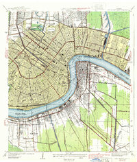
1939 · New Orleans East
USGS Topo · 1:31,680