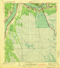
1940 Map of Belle Chasse
USGS Topo · Published 1940About this map
Mississippi River meanders through this 1938 survey, revealing a landscape defined by the heavy industry and agricultural engineering of coastal Louisiana. The western bank is anchored by Belle Chasse, where the Sea Train Terminal and the Missouri Pacific railroad tracks suggest a bustling mid-century transit hub. Across the water, the dramatic bend at English Turn gives way to settlements like Braithwaite and St Clair, which are bordered by an extensive network of drainage projects. A complex system of waterways, including the Stella Canal, Promised Land Canal, and Caernarvon Canal, illustrates the effort to manage the marshy terrain between the river and Lake Lery. This map captures the region before extensive modern levee and canal modifications, showing how rail lines like the Louisiana Southern and Southern connected riverside communities through the wetlands.
Find a feature on this map
32 named features on this map. Tap any name to fly to it.
Don’t see what you’re looking for? This feature index may not catch every label — zoom into the map to look around manually.
Map Details
Editions of this 1940 Belle Chasse Map
This is the sole edition of this map. No revisions or reprints were ever made.
Other maps of this area

1891 · Pointe a La Hache
USGS Topo · 1:62,500

1891 · New Orleans
USGS Topo · 1:62,500

1892 · Barataria
USGS Topo · 1:62,500

1892 · St. Bernard
USGS Topo · 1:62,500

1892 · Pointe a La Hache
USGS Topo · 1:62,500

1932 · New Orleans NE
USGS Topo · 1:31,680

1932 · New Orleans SE
USGS Topo · 1:31,680

1935 · Delacroix
USGS Topo · 1:31,680

1935 · Lake Batola
USGS Topo · 1:31,680
1939 · New Orleans East
USGS Topo · 1:31,680