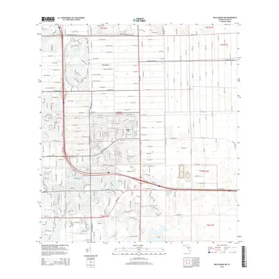
2015 Map of Belle Meade NW
USGS Topo · Published 2015About this map
The master-planned community of Vineyards and the expansive residential grid of Golden Gate dominate this mid-2010s landscape in Collier County. The map captures a period of intense suburban development characterized by complex residential street networks and extensive water management systems, including the namesake Magnolia Pond Dr. Major transportation corridors like Vanderbilt Beach Rd and Pine Ridge Rd frame the northern sections, while Golden Gate Pky and Davis Blvd provide vital east-west connectivity through the southern reaches. This survey documents the transition of Florida's interior wetlands into a high-density suburban environment, where the precise geometries of residential developments meet the structured commercial zones along City Gate Blvd N. Local historians and genealogists can trace the evolution of neighborhood names and the rapid expansion of the road network that defines modern Southwest Florida.
Find a feature on this map
22 named features on this map. Tap any name to fly to it.
Don’t see what you’re looking for? This feature index may not catch every label — zoom into the map to look around manually.
Map Details
Editions of this 2015 Belle Meade NW Map
This is the sole edition of this map. No revisions or reprints were ever made.
Other maps of this area

1956 · West Palm Beach
USGS Topo · 1:250,000

1957 · West Palm Beach
USGS Topo · 1:250,000

1958 · West Palm Beach
USGS Topo · 1:250,000

1958 · Corkscrew SE
USGS Topo · 1:24,000

1958 · Bonita Springs
USGS Topo · 1:24,000

1958 · Belle Meade
USGS Topo · 1:24,000

1958 · Naples South
USGS Topo · 1:24,000

1958 · Belle Meade NE
USGS Topo · 1:24,000

1958 · Belle Meade NW
USGS Topo · 1:24,000

1958 · Corkscrew SW
USGS Topo · 1:24,000