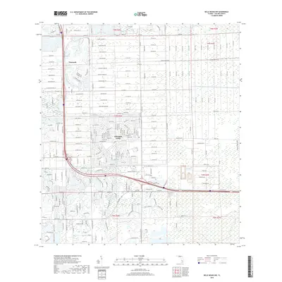
2018 Map of Belle Meade NW
USGS Topo · Published 2018About this map
Golden Gate and Vineyards dominate this 2018 survey, reflecting the intensive residential development of Collier County. The map reveals a highly structured suburban landscape, characterized by winding residential streets and gated communities organized into specific wood-themed enclaves. Along Oakes Blvd, developments like Village Walk Cir and Vistana Cir demonstrate the modern land-use patterns typical of this Florida region, where planned water features like Magnolia Pond Dr are integrated into the street grid.
Find a feature on this map
196 named features on this map. Tap any name to fly to it.
Don’t see what you’re looking for? This feature index may not catch every label — zoom into the map to look around manually.
Map Details
Editions of this 2018 Belle Meade NW Map
This is the sole edition of this map. No revisions or reprints were ever made.
Other maps of this area

1956 · West Palm Beach
USGS Topo · 1:250,000

1957 · West Palm Beach
USGS Topo · 1:250,000

1958 · West Palm Beach
USGS Topo · 1:250,000

1958 · Corkscrew SE
USGS Topo · 1:24,000

1958 · Bonita Springs
USGS Topo · 1:24,000

1958 · Belle Meade
USGS Topo · 1:24,000

1958 · Naples South
USGS Topo · 1:24,000

1958 · Belle Meade NE
USGS Topo · 1:24,000

1958 · Belle Meade NW
USGS Topo · 1:24,000

1958 · Corkscrew SW
USGS Topo · 1:24,000