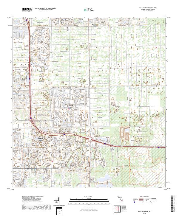
2024 Map of Belle Meade NW
USGS Topo · Published 2024About this map
Golden Gate and the sprawling residential communities east of Naples define this modern landscape, characterized by an extensive network of canals and residential developments. The area is anchored by established neighborhoods such as Vineyards, Island Walk, and Berkshire Lakes, showing the continued inland expansion in Collier County. The map provides precise detail for local landmarks, including Saint Agnes Catholic Church and the nearby Columbarium, along with the Palm Royale Cem.
Find a feature on this map
24 named features on this map. Tap any name to fly to it.
Don’t see what you’re looking for? This feature index may not catch every label — zoom into the map to look around manually.
Map Details
Editions of this 2024 Belle Meade NW Map
This is the sole edition of this map. No revisions or reprints were ever made.
Other maps of this area

1956 · West Palm Beach
USGS Topo · 1:250,000

1957 · West Palm Beach
USGS Topo · 1:250,000

1958 · West Palm Beach
USGS Topo · 1:250,000

1958 · Corkscrew SE
USGS Topo · 1:24,000

1958 · Bonita Springs
USGS Topo · 1:24,000

1958 · Belle Meade
USGS Topo · 1:24,000

1958 · Naples South
USGS Topo · 1:24,000

1958 · Belle Meade NE
USGS Topo · 1:24,000

1958 · Belle Meade NW
USGS Topo · 1:24,000

1958 · Corkscrew SW
USGS Topo · 1:24,000