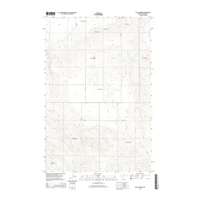
2014 Map of Belle Prairie
USGS Topo · Published 2014About this map
Belle Prairie sits at the center of this Dawson County landscape, characterized by the intricate drainage systems of the Montana plains. The terrain is defined by a network of seasonal watercourses and coulees, including Wards Coulee, Coal Coulee, and Elm Coulee, which carve through the high ground towards the northeast. This 2014 survey reveals a sparse settlement pattern dominated by a strictly gridded section-line road system, including Road 311 and Road 320, which navigate the rises and falls of the prairie. In the southwest corner, the elevation breaks significantly at Bryants Buttes, providing a notable landmark above the surrounding flats. The map documents the persistent agricultural and ranching layout of the region, where water remains the primary driver of the local geography as seen in the paths of Serrine Cr and Cotton Cr.
Find a feature on this map
18 named features on this map. Tap any name to fly to it.
Don’t see what you’re looking for? This feature index may not catch every label — zoom into the map to look around manually.
Map Details
Editions of this 2014 Belle Prairie Map
This is the sole edition of this map. No revisions or reprints were ever made.
Other maps of this area

1909 · Glendive
USGS Topo · 1:250,000

1954 · Glendive
USGS Topo · 1:250,000

1957 · Glendive
USGS Topo · 1:250,000

1958 · Glendive
USGS Topo · 1:250,000

1966 · Kolberg Ranch
USGS Topo · 1:24,000

1966 · Savage SW
USGS Topo · 1:24,000

1966 · Intake
USGS Topo · 1:24,000

1967 · Stipek
USGS Topo · 1:24,000

1967 · Allard
USGS Topo · 1:24,000

1967 · Belle Prairie
USGS Topo · 1:24,000