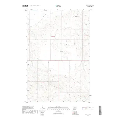
2020 Map of Belle Prairie
USGS Topo · Published 2020About this map
Belle Prairie sits at the center of this Dawson County landscape, where the high plains are deeply incised by a complex network of seasonal drainages. This recent 2020 survey reveals a topography defined by erosion and ranching access, with prominent elevations like Bryants Buttes rising above the surrounding coulees. The drainage pattern is the dominant natural feature, characterized by the winding paths of Cotton Cr and Serrine Cr, which cut through the undulating terrain. A grid of rural routes, including RD 320 and RD 311, provides the primary infrastructure for this sparsely populated region. The map highlights the intersection of several townships, including t17n r56e and t16n r57e, illustrating the enduring influence of the Public Land Survey System on Montana’s rural development and land management.
Find a feature on this map
18 named features on this map. Tap any name to fly to it.
Don’t see what you’re looking for? This feature index may not catch every label — zoom into the map to look around manually.
Map Details
Editions of this 2020 Belle Prairie Map
This is the sole edition of this map. No revisions or reprints were ever made.
Other maps of this area

1909 · Glendive
USGS Topo · 1:250,000

1954 · Glendive
USGS Topo · 1:250,000

1957 · Glendive
USGS Topo · 1:250,000

1958 · Glendive
USGS Topo · 1:250,000

1966 · Kolberg Ranch
USGS Topo · 1:24,000

1966 · Savage SW
USGS Topo · 1:24,000

1966 · Intake
USGS Topo · 1:24,000

1967 · Stipek
USGS Topo · 1:24,000

1967 · Allard
USGS Topo · 1:24,000

1967 · Belle Prairie
USGS Topo · 1:24,000