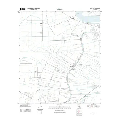
2012 Map of Belle Rose
USGS Topo · Published 2012About this map
Bayou Lafourche serves as the primary artery for a landscape defined by traditional French-heritage settlements and agricultural infrastructure. Radiating from the banks of the Mississippi River at Smoke Bend and McCall, the terrain is marked by a distinctive long-lot pattern of land division, seen in the road layouts of Palo Alto and Belle Alliance. This survey documents the intersection of legacy plantation names and industrial development, including the Napoleonville Oil and Gas Field. Genealogists will find significant value in the distribution of family and parish landmarks, such as Saint Martins Cem, Virginia Cem, and Saint Augustine Cem. Aviation and recreation also leave their mark on the parish through the Cane-Air Airport, the Belle Alliance Landing Strip, and the No Problem Raceway Park.
Find a feature on this map
113 named features on this map. Tap any name to fly to it.
Don’t see what you’re looking for? This feature index may not catch every label — zoom into the map to look around manually.
Map Details
Editions of this 2012 Belle Rose Map
This is the sole edition of this map. No revisions or reprints were ever made.
Other maps of this area

1892 · Donaldsonville
USGS Topo · 1:62,500

1892 · Thibodaux
USGS Topo · 1:62,500

1927 · Thibodaux NW
USGS Topo · 1:31,680

1935 · Gonzales
USGS Topo · 1:31,680

1936 · White Castle
USGS Topo · 1:62,500

1939 · Donaldsonville
USGS Topo · 1:62,500

1940 · Madewood
USGS Topo · 1:31,680

1945 · New Orleans
USGS Topo · 1:250,000

1947 · Donaldsonville
USGS Topo · 1:31,680

1953 · Napoleonville
USGS Topo · 1:62,500