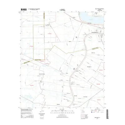
2015 Map of Belle Rose
USGS Topo · Published 2015About this map
Donaldsonville and the winding course of the Mississippi River anchor this 2015 study of the river parish landscape. The map captures the distinctive long-lot settlement patterns characteristic of southern Louisiana, where property lines extend away from the Mississippi River and Bayou Lafourche. A series of historic community names like Belle Alliance, Belle Rose, and Bruly Saint Martin line the waterways, reflecting the region's French-influenced heritage and agricultural development. Genealogists and local historians will find significant detail in the numerous burial grounds documented, including Saint Martins Cem, Emanuel Cem, and Saint Jules Cem. The drainage network, featuring McCall Bayou, Bayou Napoleon, and Bayou Crouix, illustrates the complex hydrologic system that has shaped the growth of settlements like Klotzville, Smoke Bend, and Palo Alto over generations.
Find a feature on this map
125 named features on this map. Tap any name to fly to it.
Don’t see what you’re looking for? This feature index may not catch every label — zoom into the map to look around manually.
Map Details
Editions of this 2015 Belle Rose Map
This is the sole edition of this map. No revisions or reprints were ever made.
Other maps of this area

1892 · Donaldsonville
USGS Topo · 1:62,500

1892 · Thibodaux
USGS Topo · 1:62,500

1927 · Thibodaux NW
USGS Topo · 1:31,680

1935 · Gonzales
USGS Topo · 1:31,680

1936 · White Castle
USGS Topo · 1:62,500

1939 · Donaldsonville
USGS Topo · 1:62,500

1940 · Madewood
USGS Topo · 1:31,680

1945 · New Orleans
USGS Topo · 1:250,000

1947 · Donaldsonville
USGS Topo · 1:31,680

1953 · Napoleonville
USGS Topo · 1:62,500