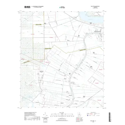
2018 Map of Belle Rose
USGS Topo · Published 2018About this map
Mississippi River and Bayou Lafourche converge near the established center of Donaldsonville, anchoring a landscape defined by historic river-bend settlements and long-lot land divisions. This corridor through Ascension and Assumption Parishes is dense with community landmarks, particularly a high concentration of burial grounds such as Saint Martins Cem, Saint Jules Cem, and Saint Augustine Cem. The map illustrates the persistent influence of the river's path on local geography, from the bend at Smoke Bend to the specialized aviation footprint of the Cane-Air Airport. Small communities like Bruly Saint Martin, Klotzville, and Barton are linked by a network of roads that follow the bayou and riverbanks, reflecting a centuries-old settlement pattern dictated by the alluvial terrain of south Louisiana.
Find a feature on this map
98 named features on this map. Tap any name to fly to it.
Don’t see what you’re looking for? This feature index may not catch every label — zoom into the map to look around manually.
Map Details
Editions of this 2018 Belle Rose Map
This is the sole edition of this map. No revisions or reprints were ever made.
Other maps of this area

1892 · Donaldsonville
USGS Topo · 1:62,500

1892 · Thibodaux
USGS Topo · 1:62,500

1927 · Thibodaux NW
USGS Topo · 1:31,680

1935 · Gonzales
USGS Topo · 1:31,680

1936 · White Castle
USGS Topo · 1:62,500

1939 · Donaldsonville
USGS Topo · 1:62,500

1940 · Madewood
USGS Topo · 1:31,680

1945 · New Orleans
USGS Topo · 1:250,000

1947 · Donaldsonville
USGS Topo · 1:31,680

1953 · Napoleonville
USGS Topo · 1:62,500