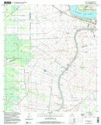
1999 Map of Belle Rose
USGS Topo · Published 2000About this map
Mississippi River and Bayou Lafourche dictate the patterns of settlement in this sugar-producing region, where ribbon-like property lines stretch away from the water. The bustling town of Donaldsonville sits at the northern confluence, serving as a hub for the surrounding parishes. Smaller communities like Smoke Bend, Palo Alto, and Belle Rose line the banks, interspersed with active agricultural land including a dedicated Crawfish Farm and a Gas and Oil Field. Private aviation is well represented by the Cane-Air Landing Strip and Belle Alliance Landing Strip, reflecting the modern industrial needs of the landscape. Local genealogists will find several small settlements such as Sweet Home, Freetown, and Klotzville, alongside the Virginia Ch and numerous local cemeteries.
Find a feature on this map
42 named features on this map. Tap any name to fly to it.
Don’t see what you’re looking for? This feature index may not catch every label — zoom into the map to look around manually.
Map Details
Editions of this 1999 Belle Rose Map
This is the sole edition of this map. No revisions or reprints were ever made.
Other maps of this area

1892 · Donaldsonville
USGS Topo · 1:62,500

1892 · Thibodaux
USGS Topo · 1:62,500

1927 · Thibodaux NW
USGS Topo · 1:31,680

1935 · Gonzales
USGS Topo · 1:31,680

1936 · White Castle
USGS Topo · 1:62,500

1939 · Donaldsonville
USGS Topo · 1:62,500

1940 · Madewood
USGS Topo · 1:31,680

1945 · New Orleans
USGS Topo · 1:250,000

1947 · Donaldsonville
USGS Topo · 1:31,680

1953 · Napoleonville
USGS Topo · 1:62,500