2023 Map of Bellefonte
USGS Topo · Published 2023About this map
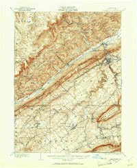
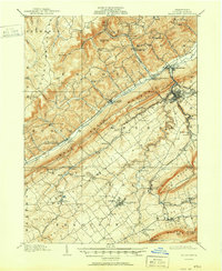
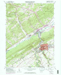
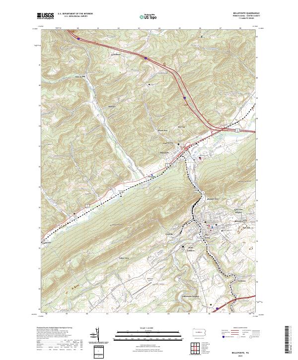
Bellefonte serves as the focal point of this Central Pennsylvania landscape, anchored by the Centre County Courthouse and the historic Big Spring. The settlement pattern follows the valley floor between Bald Eagle Mountain and the rising terrain of Nittany Valley, with neighborhoods like Bush Addition and Park View Heights expanding the borough's footprint. The industrial and transit legacy of the region is etched into the map through the winding path of the Nittany and Bald Eagle RR and numerous family-named cemeteries such as Fairview Cem and Advent Cem.
Find a feature on this map
146 named features on this map. Tap any name to fly to it.
Don’t see what you’re looking for? This feature index may not catch every label — zoom into the map to look around manually.
Map Details
Editions of this 2023 Bellefonte Map
This is the sole edition of this map. No revisions or reprints were ever made.
Historical Maps of Milesburg Through Time
6 maps found