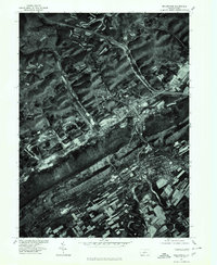
1977 Map of Bellefonte
USGS Topo · Published 1979About this map
Bald Eagle Mountain dominates the landscape in this late 1970s orthophotoquad, creating a massive natural barrier that defines the valley's settlement patterns. Along its northern base, Bald Eagle Creek cuts through the terrain, providing a vital water source and a corridor for the local infrastructure. This imagery-based study reveals the distinct contrast between the wooded slopes of the mountain and the developed areas of Runville and Coleville. The map captures the footprint of these communities and the surrounding agricultural parcels just as they appeared in the late 1970s, before decades of modern growth altered the rural character of this Centre County region. Researchers can observe the exact alignment of roads and property clearings tucked between the creek and the rising mountain ridge.
Find a feature on this map
4 named features on this map. Tap any name to fly to it.
Don’t see what you’re looking for? This feature index may not catch every label — zoom into the map to look around manually.
Map Details
Editions of this 1977 Bellefonte Map
This is the sole edition of this map. No revisions or reprints were ever made.
Other maps of this area

1908 · Bellefonte
USGS Topo · 1:62,500

1909 · Bellefonte
USGS Topo · 1:62,500

1921 · Howard
USGS Topo · 1:48,000

1923 · Howard
USGS Topo · 1:62,500

1924 · Centre Hall
USGS Topo · 1:62,500

1928 · Snow Shoe
USGS Topo · 1:48,000

1929 · Centre Hall
USGS Topo · 1:62,500

1931 · Show Shoe
USGS Topo · 1:62,500

1943 · Lewistown
USGS Topo · 1:125,000

1950 · Harrisburg
USGS Topo · 1:250,000