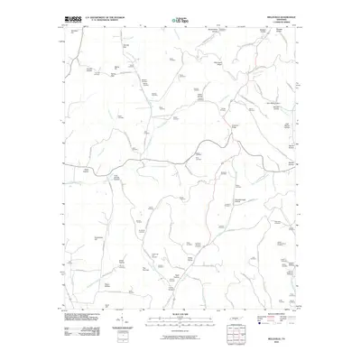
2010 Map of Belleville
USGS Topo · Published 2010About this map
Richmond Ridge and Chestnut Ridge define the topographic character of this Lincoln County landscape, where a dense network of family-named hollows and cemeteries reveals a deeply rooted rural community. The settlement pattern follows the narrow valleys of Norris Creek and Little Cane Creek, with land use dictated by the steep terrain of the Highland Rim. A remarkable concentration of burial grounds, including Sorrells Cemetery, Bledsoe Cemetery, and Foster Cemetery, provides a significant map for genealogical research in the area. The geography is marked by distinctive natural features such as The Narrows and Hannah Gap, which historically influenced local transit and property boundaries. Narrow winding routes like Three Hundred Dollar Rd and Poor Grab Chestnut Ridge Rd provide access to the more isolated upland reaches and hollows.
Find a feature on this map
122 named features on this map. Tap any name to fly to it.
Don’t see what you’re looking for? This feature index may not catch every label — zoom into the map to look around manually.
Map Details
Editions of this 2010 Belleville Map
This is the sole edition of this map. No revisions or reprints were ever made.
Other maps of this area

1936 · Booneville
USGS Topo · 1:24,000

1936 · Shelbyville
USGS Topo · 1:24,000

1936 · Belfast
USGS Topo · 1:24,000

1936 · Belleville
USGS Topo · 1:24,000

1936 · Boonshill
USGS Topo · 1:24,000

1936 · Petersburg
USGS Topo · 1:24,000

1936 · Bedford
USGS Topo · 1:24,000

1936 · Mulberry
USGS Topo · 1:24,000

1936 · Fayetteville
USGS Topo · 1:24,000

1944 · Shelbyville
USGS Topo · 1:100,000