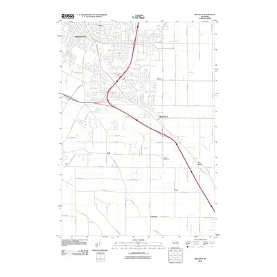
2010 Map of Bellevue
USGS Topo · Published 2010About this map
Green Bay and the surrounding township of Bellevue are depicted here during a period of significant suburban expansion in Brown County. The map captures the dense residential grid emerging southeast of the East River, transitioning into a landscape of smaller named communities like Preble, Kolb, and Pine Grove. This transition from the urban center of Green Bay to the more open lands of Glenmore is defined by a heavy reliance on a structured road network, including thoroughfares like Lime Kiln Rd and Manitowoc Rd.
Find a feature on this map
70 named features on this map. Tap any name to fly to it.
Don’t see what you’re looking for? This feature index may not catch every label — zoom into the map to look around manually.
Map Details
Editions of this 2010 Bellevue Map
This is the sole edition of this map. No revisions or reprints were ever made.
Other maps of this area

1954 · De Pere
USGS Topo · 1:62,500

1954 · Green Bay West
USGS Topo · 1:24,000

1954 · Denmark
USGS Topo · 1:62,500

1954 · De Pere
USGS Topo · 1:24,000

1954 · New Franken
USGS Topo · 1:62,500

1954 · Green Bay East
USGS Topo · 1:24,000

1954 · Manitowoc
USGS Topo · 1:250,000

1954 · Bellevue
USGS Topo · 1:24,000

1954 · Green Bay
USGS Topo · 1:62,500

1955 · Green Bay
USGS Topo · 1:250,000