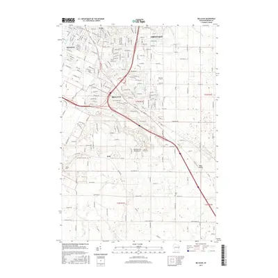
2015 Map of Bellevue
USGS Topo · Published 2015About this map
The village of Bellevue and the neighboring community of Allouez define this corridor southeast of Green Bay, showing a landscape where residential expansion meets established rural landmarks. The topography is anchored by Scray Hill and the unique geological formation at Fonferek Glen Natural Arch, which sits just south of the Kolb settlement. The map traces the winding course of the East River and Bower Cr, which cut through a network of local roads and highways like Lime Kiln Rd and Manitowoc Rd.
Find a feature on this map
58 named features on this map. Tap any name to fly to it.
Don’t see what you’re looking for? This feature index may not catch every label — zoom into the map to look around manually.
Map Details
Editions of this 2015 Bellevue Map
This is the sole edition of this map. No revisions or reprints were ever made.
Other maps of this area

1954 · De Pere
USGS Topo · 1:62,500

1954 · Green Bay West
USGS Topo · 1:24,000

1954 · Denmark
USGS Topo · 1:62,500

1954 · De Pere
USGS Topo · 1:24,000

1954 · New Franken
USGS Topo · 1:62,500

1954 · Green Bay East
USGS Topo · 1:24,000

1954 · Manitowoc
USGS Topo · 1:250,000

1954 · Bellevue
USGS Topo · 1:24,000

1954 · Green Bay
USGS Topo · 1:62,500

1955 · Green Bay
USGS Topo · 1:250,000