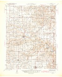
1945 Map of Bellflower
USGS Topo · Published 1945About this map
Middletown serves as a central hub at the junction of several county lines in this 1945 survey, marking a landscape defined by the winding course of the West Fork Cuivre River. The region exhibits a dense network of rural one-room schoolhouses and country churches, reflecting a localized agrarian society before the widespread consolidation of the mid-20th century. Notable landmarks include the Middletown Lodge and a significant cluster of family-named schools such as Pine Knot Sch and Meadow Lark Sch. To the south, the settlement of Bellflower and the adjacent village of Liege are connected by the Burlington railroad line, which served as the primary industrial corridor for the southern Montgomery County area. This map reveals a community structured around small townships like Prairie and Hartford, where numerous cemeteries like Payne Cem and Elmore Cem provide specific points of interest for genealogical research.
Find a feature on this map
83 named features on this map. Tap any name to fly to it.
Don’t see what you’re looking for? This feature index may not catch every label — zoom into the map to look around manually.
Map Details
Editions of this 1945 Bellflower Map
2 editions found

Other maps of this area

1890 · Louisiana
USGS Topo · 1:125,000

1890 · Mexico
USGS Topo · 1:125,000

1890 · Hermann
USGS Topo · 1:125,000

1890 · Fulton
USGS Topo · 1:125,000

1937 · Silex
USGS Topo · 1:62,500

1937 · Bowling Green
USGS Topo · 1:62,500

1939 · Silex
USGS Topo · 1:48,000

1940 · Bowling Green
USGS Topo · 1:62,500

1940 · Montgomery City
USGS Topo · 1:62,500

1942 · Montgomery City
USGS Topo · 1:62,500