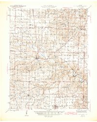
1942 Map of Bellflower
USGS Topo · Published 1966About this map
Middletown and Bellflower anchor this 1942 survey of eastern Missouri, where the agricultural landscape is intricately carved by the West Fork Cuivre River and its numerous tributaries. The rural character of the era is evidenced by a dense network of country schools and churches, including Pine Knot Sch and Smyrna Ch, which served dispersed farming families. The Chicago Burlington and Quincy railroad cuts through the southern reaches of the map, passing through the settlements of Buell and Bellflower. This transit corridor contrasts with the more dissected terrain to the north, where small landmarks like New Hartford and Gazette sit near the headwaters of Lead Creek and Sandy Creek. State Geologist Edward L. Clark oversaw this mapping effort, which documents the mid-century placement of cemeteries like Union Chapel Cem and Elkhorn Cem before modern consolidation altered the local social geography.
Find a feature on this map
72 named features on this map. Tap any name to fly to it.
Don’t see what you’re looking for? This feature index may not catch every label — zoom into the map to look around manually.
Map Details
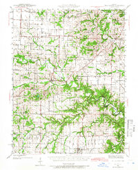
Editions of this 1942 Bellflower Map
This is the sole edition of this map. No revisions or reprints were ever made.