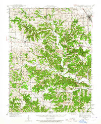
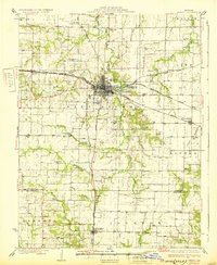
1940 Map of Montgomery City
USGS Topo · Published 1965About this map
Montgomery City serves as the focal point of this 1940s landscape, situated along the Wabash RR in a region where the prairie gives way to the deep drainages of the Loutre River. The map captures a moment when rural life centered on a dense network of one-room schools and local parishes. Educational landmarks like the Loutre Valley Sch, Union Grove Sch, and Whiteside Sch are scattered across the terrain, while spiritual life is anchored by St Patricks Ch and Johnson Chapel.
Find a feature on this map
71 named features on this map. Tap any name to fly to it.
Don’t see what you’re looking for? This feature index may not catch every label — zoom into the map to look around manually.
Map Details
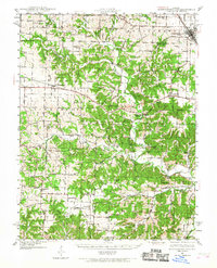
Editions of this 1940 Montgomery City Map
2 editions found
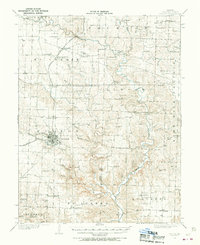
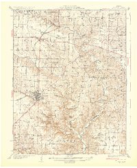
Other maps of this area

1890 · Louisiana
USGS Topo · 1:125,000

1890 · Mexico
USGS Topo · 1:125,000

1890 · Hermann
USGS Topo · 1:125,000

1890 · Fulton
USGS Topo · 1:125,000
1928 · Fulton
USGS Topo · 1:62,500
1931 · Fulton
USGS Topo · 1:62,500
1932 · Mexico
USGS Topo · 1:62,500

1935 · Morrison
USGS Topo · 1:48,000

1936 · Hermann
USGS Topo · 1:48,000
1942 · Montgomery City
USGS Topo · 1:62,500