
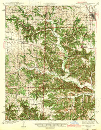
1942 Map of Montgomery City
USGS Topo · Published 1942About this map
Montgomery City serves as the regional hub at the start of the 1940s, anchored by the Wabash RR corridor in the northeast. The landscape transitions from the open stretches of Nine Mile Prairie to the dissected drainage basins of the Loutre River and its numerous tributaries. This survey, conducted just before the United States' full entry into World War II, captures a rural Missouri society defined by small-scale farming and highly localized community centers.
Find a feature on this map
74 named features on this map. Tap any name to fly to it.
Don’t see what you’re looking for? This feature index may not catch every label — zoom into the map to look around manually.
Map Details
Editions of this 1942 Montgomery City Map
2 editions found
Other maps of this area

1890 · Louisiana
USGS Topo · 1:125,000

1890 · Mexico
USGS Topo · 1:125,000

1890 · Hermann
USGS Topo · 1:125,000

1890 · Fulton
USGS Topo · 1:125,000

1928 · Fulton
USGS Topo · 1:62,500

1931 · Fulton
USGS Topo · 1:62,500

1932 · Mexico
USGS Topo · 1:62,500

1935 · Morrison
USGS Topo · 1:48,000

1936 · Hermann
USGS Topo · 1:48,000

1940 · Montgomery City
USGS Topo · 1:62,500