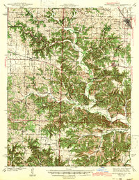
1942 Map of Montgomery City
USGS Topo · Published 1942About this map
Loutre Creek and the Loutre River carve a winding course through this section of central Missouri, shaping a landscape defined by sharp elevation changes and narrow valleys. At the dawn of the 1940s, the region maintained a dense network of rural infrastructure, visible in the high concentration of one-room schoolhouses such as Whiteside Sch, Gill Sch, and Prairie Fork Sch. These schools, along with country churches like Antioch Ch and St Patricks Ch, served as the primary social anchors for the surrounding farmsteads.
Find a feature on this map
55 named features on this map. Tap any name to fly to it.
Don’t see what you’re looking for? This feature index may not catch every label — zoom into the map to look around manually.
Map Details
Editions of this 1942 Montgomery City Map
2 editions found

Other maps of this area

1890 · Louisiana
USGS Topo · 1:125,000

1890 · Mexico
USGS Topo · 1:125,000

1890 · Hermann
USGS Topo · 1:125,000

1890 · Fulton
USGS Topo · 1:125,000

1928 · Fulton
USGS Topo · 1:62,500

1931 · Fulton
USGS Topo · 1:62,500

1932 · Mexico
USGS Topo · 1:62,500

1935 · Morrison
USGS Topo · 1:48,000

1936 · Hermann
USGS Topo · 1:48,000

1940 · Montgomery City
USGS Topo · 1:62,500