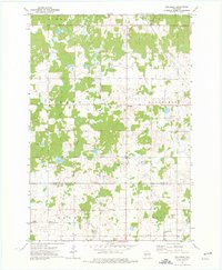
1973 Map of Bellinger
USGS Topo · Published 1976About this map
The North Fork Eau Claire River and its many tributaries, including Otter Creek and Hay Creek, define this rural section of Central Wisconsin during the early 1970s. The landscape is a patchwork of woodland and wetlands, structured by a rigid grid of rural roads like Ness Drive and School Road. Cultural landmarks are few but significant to local history, such as the Ukrainian Orthodox Ch and an adjacent Cem located near the boundary between Taylor and Clark counties.
Find a feature on this map
30 named features on this map. Tap any name to fly to it.
Don’t see what you’re looking for? This feature index may not catch every label — zoom into the map to look around manually.
Map Details
Editions of this 1973 Bellinger Map
This is the sole edition of this map. No revisions or reprints were ever made.
Other maps of this area

1951 · Lublin
USGS Topo · 1:48,000

1951 · Gilman
USGS Topo · 1:62,500

1952 · Stanley
USGS Topo · 1:62,500

1953 · Owen
USGS Topo · 1:48,000

1953 · Eau Claire
USGS Topo · 1:250,000

1953 · Rice Lake
USGS Topo · 1:250,000

1958 · Eau Claire
USGS Topo · 1:250,000

1959 · Rice Lake
USGS Topo · 1:250,000

1963 · Owen
USGS Topo · 1:62,500

1964 · Eau Claire
USGS Topo · 1:250,000