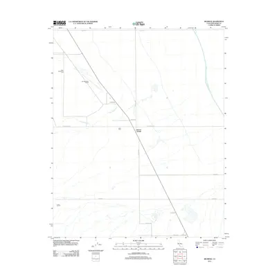
2012 Map of Belridge
USGS Topo · Published 2012About this map
Industrial extraction and water infrastructure dominate this Kern County landscape, centered on the Missouri Triangle and the expansive operations of the South Belridge Oil Field. The terrain is etched with a network of service roads and pipeline corridors, including Cymric Rd and Lokern Rd, supporting the active energy sector at the Cymric Oil Field. This 2012 survey illustrates the intersection of oil production and massive water projects, most notably the Governor Edmund G Brown California Aqueduct which cuts across the northeast corner of the quadrangle.
Find a feature on this map
16 named features on this map. Tap any name to fly to it.
Don’t see what you’re looking for? This feature index may not catch every label — zoom into the map to look around manually.
Map Details
Editions of this 2012 Belridge Map
This is the sole edition of this map. No revisions or reprints were ever made.
Other maps of this area

1912 · McKittrick
USGS Topo · 1:125,000

1914 · Lost Hills
USGS Topo · 1:125,000

1927 · Semitropic
USGS Topo · 1:31,680

1931 · Lokern
USGS Topo · 1:31,680

1931 · Goose Lake
USGS Topo · 1:31,680

1932 · West Elk Hills
USGS Topo · 1:31,680

1932 · West of Goose Lake
USGS Topo · 1:31,680

1934 · Lokern
USGS Topo · 1:31,680

1934 · West of Goose Lake
USGS Topo · 1:31,680
1942 · Hart Station
USGS Topo · 1:62,500