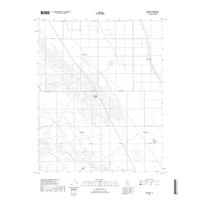
2018 Map of Belridge
USGS Topo · Published 2018About this map
Missouri Triangle sits at the heart of this Kern County landscape, where the flat expanse of the San Joaquin Valley meets the rising terrain of the west. The modern industrial and agricultural infrastructure is defined by the massive Governor Edmund G Brown California Aqueduct, which cuts a straight line through the eastern portion of the survey area. Seasonal drainage patterns like Chico Martinez Cr and Salt Cr descend from the Temblor Valley toward the valley floor, crossing a rigid grid of transit corridors such as Lerdo Hwy and Lost Hills Rd. This 2018 survey documents the intersection of high-capacity water transport and the historic road network in one of California's primary energy and farming regions.
Find a feature on this map
21 named features on this map. Tap any name to fly to it.
Don’t see what you’re looking for? This feature index may not catch every label — zoom into the map to look around manually.
Map Details
Editions of this 2018 Belridge Map
This is the sole edition of this map. No revisions or reprints were ever made.
Other maps of this area

1912 · McKittrick
USGS Topo · 1:125,000

1914 · Lost Hills
USGS Topo · 1:125,000

1927 · Semitropic
USGS Topo · 1:31,680

1931 · Lokern
USGS Topo · 1:31,680

1931 · Goose Lake
USGS Topo · 1:31,680

1932 · West Elk Hills
USGS Topo · 1:31,680

1932 · West of Goose Lake
USGS Topo · 1:31,680

1934 · Lokern
USGS Topo · 1:31,680

1934 · West of Goose Lake
USGS Topo · 1:31,680
1942 · Hart Station
USGS Topo · 1:62,500