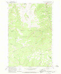
1967 Map of Belt Park Butte
USGS Topo · Published 1969About this map
Neihart and the steep gulches of the Little Belt Mountains define this late 1960s survey within the Lewis and Clark National Forest. The landscape is a complex network of high-altitude drainages, where mining history is evident in the numerous prospects and prospect pits scattered across the slopes. The topography transitions from the high peaks of Keegan Peak and Belt Park Butte down to the narrow valley floor of Belt Creek. Notable for genealogists and local historians, the Neihart Cem sits on a terrace above the main townsite, overlooking the junction of Little Belt Creek and Headstone Gulch. The map records a series of high-mountain meadows or parks, including Wilson Park, Wet Park, and Rocking Chair Park, connected by a system of rugged pack trails and jeep trails that traverse Quartzite Ridge.
Find a feature on this map
40 named features on this map. Tap any name to fly to it.
Don’t see what you’re looking for? This feature index may not catch every label — zoom into the map to look around manually.
Map Details
Editions of this 1967 Belt Park Butte Map
2 editions found
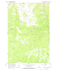
Other maps of this area

1886 · Little Belt Mts.
USGS Topo · 1:250,000

1890 · Fort Benton
USGS Topo · 1:250,000

1892 · Fort Benton
USGS Topo · 1:250,000

1894 · Little Belt Mts.
USGS Topo · 1:250,000

1897 · Fort Benton
USGS Topo · 1:250,000

1897 · Little Belt Mts.
USGS Topo · 1:250,000

1898 · Little Belt Mts.
USGS Topo · 1:250,000

1902 · Little Belt Mts.
USGS Topo · 1:250,000

1948 · White Sulphur Springs
USGS Topo · 1:250,000

1954 · Great Falls
USGS Topo · 1:250,000