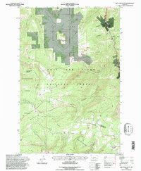
1995 Map of Belt Park Butte
USGS Topo · Published 1997About this map
Lewis and Clark National Forest encompasses this section of the Belt Mountains, where steep ridgelines like Quartzite Ridge and high summits including Keegan Peak define the high country. In the northern reaches, the open expanse of Belt Park sits near the prominent Belt Park Butte, reflecting the high-altitude meadow systems typical of the Little Belt range. The landscape is marked by the legacy of resource extraction, with numerous Prospects and a Gravel Pit scattered across the drainages.
Find a feature on this map
63 named features on this map. Tap any name to fly to it.
Don’t see what you’re looking for? This feature index may not catch every label — zoom into the map to look around manually.
Map Details
Editions of this 1995 Belt Park Butte Map
This is the sole edition of this map. No revisions or reprints were ever made.
Other maps of this area

1886 · Little Belt Mts.
USGS Topo · 1:250,000

1890 · Fort Benton
USGS Topo · 1:250,000

1892 · Fort Benton
USGS Topo · 1:250,000

1894 · Little Belt Mts.
USGS Topo · 1:250,000

1897 · Fort Benton
USGS Topo · 1:250,000

1897 · Little Belt Mts.
USGS Topo · 1:250,000

1898 · Little Belt Mts.
USGS Topo · 1:250,000

1902 · Little Belt Mts.
USGS Topo · 1:250,000

1948 · White Sulphur Springs
USGS Topo · 1:250,000

1954 · Great Falls
USGS Topo · 1:250,000