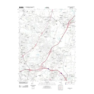
2011 Map of Beltsville
USGS Topo · Published 2011About this map
The suburban and academic corridors of the Maryland suburbs between Washington and Baltimore are meticulously charted in this study of the Beltsville area. The landscape is defined by its institutional and agricultural history, most notably the sprawling University of Maryland Plant Research Farm and the historic transit route of Old Columbia Pike. Local genealogy and community development are anchored by numerous burial grounds, including Saint Johns Cemetery and Queens Chapel Cemetery, which sit alongside established residential enclaves like Beltsville and Ammendale. Significant industrial and hydraulic footprints are visible through the Contee Main Settling Pond and its associated dam, while the Burtonsville Lookout Tower remains a prominent local landmark. The map documents a complex network of waterways, including the Northwest Branch Anacostia River and Little Paint Branch, which thread through the developing neighborhood tracts.
Find a feature on this map
128 named features on this map. Tap any name to fly to it.
Don’t see what you’re looking for? This feature index may not catch every label — zoom into the map to look around manually.
Map Details
Editions of this 2011 Beltsville Map
This is the sole edition of this map. No revisions or reprints were ever made.
Other maps of this area

1890 · Mt. Vernon
USGS Topo · 1:125,000

1891 · Mt. Vernon
USGS Topo · 1:125,000

1892 · Laurel
USGS Topo · 1:62,500

1893 · Frederick
USGS Topo · 1:125,000

1894 · Laurel
USGS Topo · 1:62,500

1894 · Frederick
USGS Topo · 1:125,000

1894 · Mt. Vernon
USGS Topo · 1:125,000

1897 · Laurel
USGS Topo · 1:62,500

1897 · Mt. Vernon
USGS Topo · 1:125,000

1899 · Patuxent
USGS Topo · 1:125,000