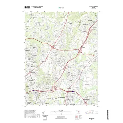
2019 Map of Beltsville
USGS Topo · Published 2019About this map
The boundary between Montgomery County and Prince George's County bisects this late-2010s landscape, revealing a dense network of suburban developments and research facilities. At the heart of the area lies the sprawling USA Adelphi Laboratory Center, surrounded by numerous established neighborhoods such as White Oak, Fairland, and Hillandale. The transition from historic rural origins to a major metropolitan corridor is evident in the survival of many local burial grounds and religious landmarks, including Union Cem and Saint John's Episcopal Church Cem.
Find a feature on this map
188 named features on this map. Tap any name to fly to it.
Don’t see what you’re looking for? This feature index may not catch every label — zoom into the map to look around manually.
Map Details
Editions of this 2019 Beltsville Map
This is the sole edition of this map. No revisions or reprints were ever made.
Other maps of this area

1890 · Mt. Vernon
USGS Topo · 1:125,000

1891 · Mt. Vernon
USGS Topo · 1:125,000

1892 · Laurel
USGS Topo · 1:62,500

1893 · Frederick
USGS Topo · 1:125,000

1894 · Laurel
USGS Topo · 1:62,500

1894 · Frederick
USGS Topo · 1:125,000

1894 · Mt. Vernon
USGS Topo · 1:125,000

1897 · Laurel
USGS Topo · 1:62,500

1897 · Mt. Vernon
USGS Topo · 1:125,000

1899 · Patuxent
USGS Topo · 1:125,000