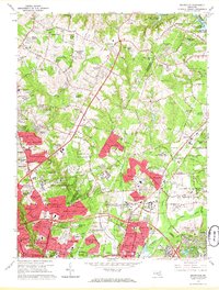
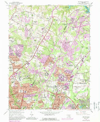
1964 Map of Beltsville
USGS Topo · Published 1966About this map
Paint Branch and Indian Creek drain the landscape of northern Prince George's and eastern Montgomery counties during this mid-1960s period of suburban expansion. The map captures a moment when large federal and institutional landholdings, such as the U S Naval Ordnance Laboratory and the University of Maryland Plant Research Farm, remained intact amidst a growing network of residential subdivisions like Calverton, Hillandale Forest, and Springbrook Manor.
Find a feature on this map
145 named features on this map. Tap any name to fly to it.
Don’t see what you’re looking for? This feature index may not catch every label — zoom into the map to look around manually.
Map Details
Editions of this 1964 Beltsville Map
5 editions found
Other maps of this area

1890 · Mt. Vernon
USGS Topo · 1:125,000

1891 · Mt. Vernon
USGS Topo · 1:125,000

1892 · Laurel
USGS Topo · 1:62,500

1893 · Frederick
USGS Topo · 1:125,000

1894 · Laurel
USGS Topo · 1:62,500

1894 · Frederick
USGS Topo · 1:125,000

1894 · Mt. Vernon
USGS Topo · 1:125,000

1897 · Laurel
USGS Topo · 1:62,500

1897 · Mt. Vernon
USGS Topo · 1:125,000

1899 · Patuxent
USGS Topo · 1:125,000