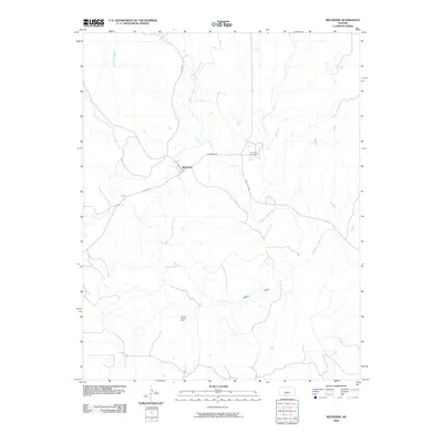
2009 Map of Belvidere
USGS Topo · Published 2009About this map
The small community of Belvidere sits at a geographic nexus in Kiowa County, where the southern plains are cut by the winding course of the Medicine Lodge River. This 2009 survey reflects a landscape defined by traditional ranching and a growing energy economy, most notably seen in the Glick Oil and Gas Field occupying the southern portion of the quadrangle. The river and its tributaries, including Soldier Creek and Spring Creek, carve distinct drainage patterns across the terrain, with Walker Draw providing further topographic variation. Local history is anchored at the Belvidere Cemetery, while a network of rural routes like Sun City Rd and Wilmore Rd connect the settlement to the broader region. The map details a transition point where the prairie's open spaces meet the structured development of resource extraction and local homesteads.
Find a feature on this map
15 named features on this map. Tap any name to fly to it.
Don’t see what you’re looking for? This feature index may not catch every label — zoom into the map to look around manually.
Map Details
Editions of this 2009 Belvidere Map
This is the sole edition of this map. No revisions or reprints were ever made.
Other maps of this area

1889 · Kinsley
USGS Topo · 1:125,000

1891 · Medicine Lodge
USGS Topo · 1:125,000

1892 · Kinsley
USGS Topo · 1:125,000

1892 · Coldwater
USGS Topo · 1:125,000

1892 · Pratt
USGS Topo · 1:125,000

1893 · Medicine Lodge
USGS Topo · 1:125,000

1894 · Kinsley
USGS Topo · 1:125,000

1894 · Pratt
USGS Topo · 1:125,000

1955 · Pratt
USGS Topo · 1:250,000

1959 · Pratt
USGS Topo · 1:250,000