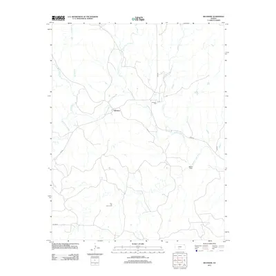
2012 Map of Belvidere
USGS Topo · Published 2012About this map
Belvidere sits at the confluence of several vital watercourses, most notably where the Medicine Lodge River meets local tributaries like Thompson Cr and Soldier Cr. The landscape is defined by the drainage patterns of the High Plains, with named features such as Walker Draw and Spring Cr etching through the terrain. The settlement itself is small, centered near the Belvidere Cem, which serves as a primary point of interest for local history and genealogical research in this part of Kiowa County.
Find a feature on this map
15 named features on this map. Tap any name to fly to it.
Don’t see what you’re looking for? This feature index may not catch every label — zoom into the map to look around manually.
Map Details
Editions of this 2012 Belvidere Map
This is the sole edition of this map. No revisions or reprints were ever made.
Other maps of this area

1889 · Kinsley
USGS Topo · 1:125,000

1891 · Medicine Lodge
USGS Topo · 1:125,000

1892 · Kinsley
USGS Topo · 1:125,000

1892 · Coldwater
USGS Topo · 1:125,000

1892 · Pratt
USGS Topo · 1:125,000

1893 · Medicine Lodge
USGS Topo · 1:125,000

1894 · Kinsley
USGS Topo · 1:125,000

1894 · Pratt
USGS Topo · 1:125,000

1955 · Pratt
USGS Topo · 1:250,000

1959 · Pratt
USGS Topo · 1:250,000