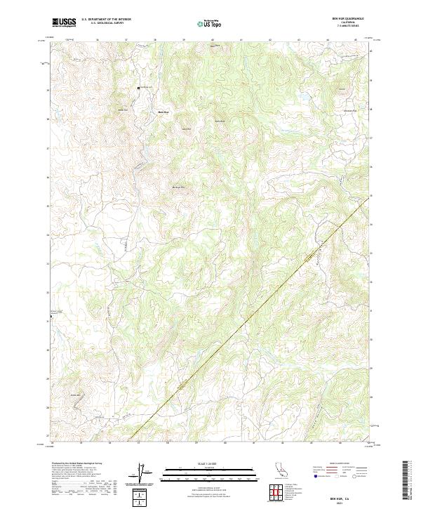
2021 Map of Ben Hur
USGS Topo · Published 2021About this map
The small community of Ben Hur serves as the focal point for this Mariposa County landscape, situated where Ben Hur Rd and Raymond Rd intersect. The terrain is characterized by a series of prominent peaks and drainage systems, including Buckeye Hill, Knob Hill, and the significant granite outcropping at Split Rock. These landforms overlook the winding course of the Chowchilla River and its numerous tributaries such as Becknell Cr and Striped Rock Cr.
Find a feature on this map
36 named features on this map. Tap any name to fly to it.
Don’t see what you’re looking for? This feature index may not catch every label — zoom into the map to look around manually.
Map Details
Editions of this 2021 Ben Hur Map
This is the sole edition of this map. No revisions or reprints were ever made.
Other maps of this area

1912 · Mariposa
USGS Topo · 1:125,000

1919 · Indian Gulch
USGS Topo · 1:48,000

1919 · Raynor Creek
USGS Topo · 1:31,680

1920 · Indian Gulch
USGS Topo · 1:62,500

1942 · Raymond
USGS Topo · 1:62,500

1944 · Raymond
USGS Topo · 1:62,500
1946 · Le Grand
USGS Topo · 1:62,500
1947 · Raynor Creek
USGS Topo · 1:24,000

1947 · Mariposa
USGS Topo · 1:24,000

1947 · San Jose
USGS Topo · 1:250,000