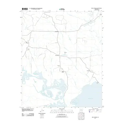
2011 Map of Ben Lomond
USGS Topo · Published 2011About this map
The Little River and the northern reaches of Millwood Lake dominate this southwestern Arkansas landscape, where a network of sloughs and branches creates a complex wetland environment. In the early 21st century, settlements like Ben Lomond, Brownstown, and White Cliffs anchor the region, connected by winding rural routes such as W Bois Dare Rdg and Graves Chapel Rd. The abundance of water features, including Grassy Lake and the Saline River confluence, suggests a geography shaped by the river's historical shifts and modern impoundments. Local history is preserved in several rural burial grounds, including Wrights Chapel Cemetery and Ben Lomond Cemetery, which serve as quiet markers of the families who settled this corner of Sevier County. Near the southern edge, Parloma Landing points to the continued significance of the river system for recreation and access to the expansive waters of Millwood Lake.
Find a feature on this map
46 named features on this map. Tap any name to fly to it.
Don’t see what you’re looking for? This feature index may not catch every label — zoom into the map to look around manually.
Map Details
Editions of this 2011 Ben Lomond Map
This is the sole edition of this map. No revisions or reprints were ever made.
Other maps of this area

1950 · Ashdown East
USGS Topo · 1:24,000

1950 · Ashdown West
USGS Topo · 1:24,000

1950 · Red Bluff
USGS Topo · 1:24,000

1950 · Ben Lomond
USGS Topo · 1:24,000

1950 · Falls Chapel
USGS Topo · 1:24,000

1951 · Ben Lomond
USGS Topo · 1:24,000

1951 · Ashdown West
USGS Topo · 1:24,000

1951 · Red Bluff
USGS Topo · 1:24,000

1951 · Falls Chapel
USGS Topo · 1:24,000

1951 · Ashdown East
USGS Topo · 1:24,000