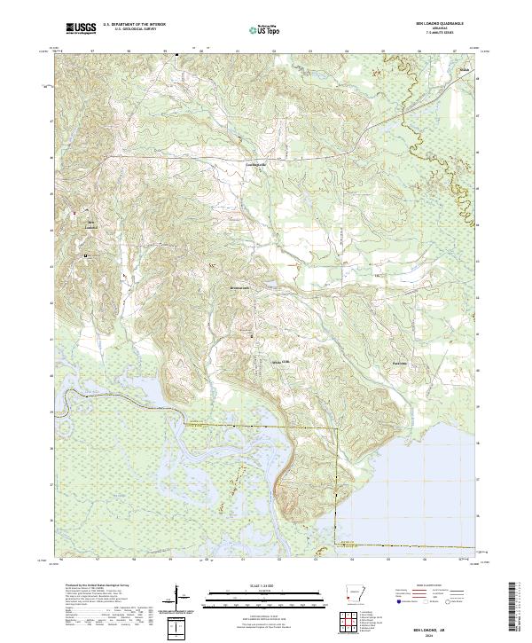
2024 Map of Ben Lomond
USGS Topo · Published 2024About this map
Ben Lomond serves as a central point of reference in this Sevier County landscape, where the Saline River and Little River wind through the southern terrain. This area is defined by its low-lying wetlands and complex water systems, including the Pond Creek National Wildlife Refuge and numerous sloughs like Sand Slough and Davis Slough. The topography is marked by distinct elevations such as W Bois D'arc Ridge and E Bois D'arc Ridge, which overlook the river bottoms. Small, established communities such as Brownstown, White Cliffs, and Paraloma are connected by a network of state highways and county roads, reflecting a long-standing rural settlement pattern. Genealogists will find the Ben Lomond Cem and Brownstown Cem significant for tracing local family histories in this corner of Arkansas.
Find a feature on this map
55 named features on this map. Tap any name to fly to it.
Don’t see what you’re looking for? This feature index may not catch every label — zoom into the map to look around manually.
Map Details
Editions of this 2024 Ben Lomond Map
This is the sole edition of this map. No revisions or reprints were ever made.
Other maps of this area

1950 · Ashdown East
USGS Topo · 1:24,000

1950 · Ashdown West
USGS Topo · 1:24,000

1950 · Red Bluff
USGS Topo · 1:24,000

1950 · Ben Lomond
USGS Topo · 1:24,000

1950 · Falls Chapel
USGS Topo · 1:24,000

1951 · Ben Lomond
USGS Topo · 1:24,000

1951 · Ashdown West
USGS Topo · 1:24,000

1951 · Red Bluff
USGS Topo · 1:24,000

1951 · Falls Chapel
USGS Topo · 1:24,000

1951 · Ashdown East
USGS Topo · 1:24,000