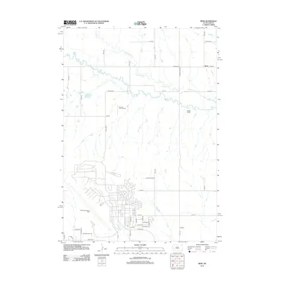
2012 Map of Bend
USGS Topo · Published 2012About this map
Ellsworth Air Force Base dominates the southwestern portion of this landscape, its sprawling residential and operational infrastructure contrasting sharply with the rural ranching terrain to the north. The winding path of Elk Cr and Dry Cr snakes across the map, carving through the high plains near Sweet Gulch. The settlement of Bend sits in the northeast corner at the intersection of Elk Creek Rd and Bend Rd, marking a quiet transition from the military density of the base to the open range. In the central section, the Running Colors Airport serves the area’s general aviation needs. The road network reflects recent growth, with residential developments expanding along Antelope Flats Dr and Liberty Blvd, while the surrounding sections remain defined by large-scale tracts and the natural drainages of Antelope Cr.
Find a feature on this map
47 named features on this map. Tap any name to fly to it.
Don’t see what you’re looking for? This feature index may not catch every label — zoom into the map to look around manually.
Map Details
Editions of this 2012 Bend Map
This is the sole edition of this map. No revisions or reprints were ever made.
Other maps of this area

1893 · Rapid
USGS Topo · 1:125,000

1898 · Rapid
USGS Topo · 1:125,000

1903 · Rapid
USGS Topo · 1:125,000

1953 · Bend
USGS Topo · 1:24,000

1953 · Rapid City 1 SW
USGS Topo · 1:24,000

1953 · Boxelder
USGS Topo · 1:24,000

1953 · Rapid City East
USGS Topo · 1:24,000

1953 · Rapid City NW
USGS Topo · 1:24,000

1953 · New Underwood SW
USGS Topo · 1:24,000

1953 · Hereford SW
USGS Topo · 1:24,000