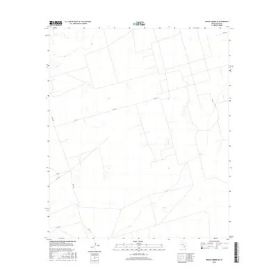
2016 Map of Benge Corner SE
USGS Topo · Published 2016About this map
Upton County ranch lands and desert plains characterize this region of West Texas, documented just as modern infrastructure began to weave through the arid landscape. The area is defined by a geometric network of property lines and access roads, including Co Rd 117 and Co Rd 308, which serve the remote ranching operations of the Permian Basin. This survey reveals a landscape where traditional land use meets modern surveying, shown through the intricate fencing and boundary patterns that crisscross the terrain. Low-lying depressions and ephemeral water features, captured by the U.S. Geological Survey, suggest the seasonal nature of water in this high-plains environment near Co Rd 111 and the northern reach of Cotton Ln.
Find a feature on this map
6 named features on this map. Tap any name to fly to it.
Don’t see what you’re looking for? This feature index may not catch every label — zoom into the map to look around manually.
Map Details
Editions of this 2016 Benge Corner SE Map
This is the sole edition of this map. No revisions or reprints were ever made.
Other maps of this area

1928 · Crane
USGS Topo · 1:125,000

1928 · Rankin
USGS Topo · 1:125,000

1954 · Pecos
USGS Topo · 1:250,000

1954 · San Angelo
USGS Topo · 1:250,000

1957 · Pecos
USGS Topo · 1:250,000

1958 · San Angelo
USGS Topo · 1:250,000

1965 · San Angelo
USGS Topo · 1:250,000

1968 · Benge Corner SE
USGS Topo · 1:24,000

1968 · Benge Corner NW
USGS Topo · 1:24,000

1968 · Midkiff NW
USGS Topo · 1:24,000