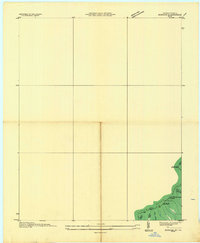
1935 Map of Benham
USGS Topo · Published 1935About this map
The Little Black Mountain ridgeline forms a high-altitude border between Kentucky and Virginia on this 1935 advance sheet. This specific survey was conducted in cooperation with the Tennessee Valley Authority and the Stonega Coal and Coke Company, reflecting the industrial interests that shaped the Harlan and Lee county lines. The map captures specialized mining operations like The Double Stonega Coal No 40 and Big Stone Gap No 5, which are critical identifiers for those researching the coal history of the Cumberland Plateau. Narrow hollows such as Marcum Hollow and McConnell Hollow drop away from the peaks, showing the steep terrain that dictated the movement of laborers and resources. A single Trail traverses the high ground near Deep Gap, representing the early infrastructure of this coal-producing borderland during the mid-1930s.
Find a feature on this map
15 named features on this map. Tap any name to fly to it.
Don’t see what you’re looking for? This feature index may not catch every label — zoom into the map to look around manually.
Map Details
Editions of this 1935 Benham Map
This is the sole edition of this map. No revisions or reprints were ever made.
Other maps of this area

1887 · Jonesville
USGS Topo · 1:125,000

1890 · Whitesburg
USGS Topo · 1:125,000

1891 · Hazard
USGS Topo · 1:125,000

1891 · Jonesville
USGS Topo · 1:125,000

1892 · Whitesburg
USGS Topo · 1:125,000

1894 · Estillville
USGS Topo · 1:125,000

1913 · Oven Fork
USGS Topo · 1:48,000

1915 · Whitesburg
USGS Topo · 1:62,500

1916 · Cornettsville
USGS Topo · 1:62,500

1916 · Nolansburg
USGS Topo · 1:48,000