
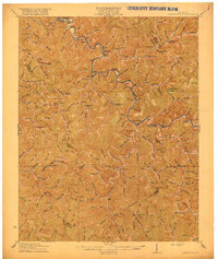
1916 Map of Cornettsville
USGS Topo · Published 1916About this map
Hazard and the surrounding coal country of Perry County are defined by the winding course of the North Fork Kentucky River and the Lexington and Eastern RR that follows its banks. Surveyed just before the First World War, the landscape is dotted with small rural settlements like Viper, Sassafras, and Cornettsville, connected by a complex web of creek-side trails and a ferry crossing. The density of numbered educational landmarks, such as School No 10 and School No 12, along with named institutions like Middle Fork School, provides a detailed record of early 20th-century social infrastructure in the Appalachian hills. Terrain features such as Nigger Br and Bear Fork illustrate the local nomenclature of the era, while the precise positioning of Dean Sta and the Boundary Line between Perry, Knott, and Letcher counties offers valuable data for genealogical and geographic research.
Find a feature on this map
162 named features on this map. Tap any name to fly to it.
Don’t see what you’re looking for? This feature index may not catch every label — zoom into the map to look around manually.
Map Details
Editions of this 1916 Cornettsville Map
3 editions found

Other maps of this area

1887 · Jonesville
USGS Topo · 1:125,000

1890 · Whitesburg
USGS Topo · 1:125,000

1891 · Hazard
USGS Topo · 1:125,000

1891 · Jonesville
USGS Topo · 1:125,000

1892 · Whitesburg
USGS Topo · 1:125,000

1894 · Estillville
USGS Topo · 1:125,000

1903 · Harlan
USGS Topo · 1:48,000

1912 · Hindman
USGS Topo · 1:48,000

1913 · Oven Fork
USGS Topo · 1:48,000

1913 · Buckhorn
USGS Topo · 1:62,500