
1913 Map of Buckhorn
USGS Topo · Published 1913About this map
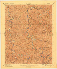
The Middle Fork Kentucky River snakes through the Cumberland Plateau, defining a landscape of isolated valleys and steep ridges long before modern highways. This 1911 survey shows the settlement of Buckhorn as an educational center anchored by Witherspoon College, while the Lexington and Eastern Ry follows the main stem of the Kentucky River through Chavies and Krypton. The map preserves the locations of numerous small one-room schools, including Red Hill School, Napier School, and Flat Gap School, reflecting the decentralized nature of rural life in Perry and Breathitt Counties. Notable landmarks like Nailors Rock and Buzzard Roost served as essential navigation points for travelers moving between the scattered homesteads near Crockettsville and Lost Creek. Clear county boundaries separate Perry from Breathitt and Leslie, tracing the ridgelines that dictated local travel and social organization at the start of the 20th century.
Find a feature on this map
76 named features on this map. Tap any name to fly to it.
Don’t see what you’re looking for? This feature index may not catch every label — zoom into the map to look around manually.
Map Details
Editions of this 1913 Buckhorn Map
2 editions found
Other maps of this area

1889 · Salyersville
USGS Topo · 1:125,000

1891 · Manchester
USGS Topo · 1:125,000

1891 · Hazard
USGS Topo · 1:125,000

1891 · Salyersville
USGS Topo · 1:125,000

1892 · Beattyville
USGS Topo · 1:125,000

1899 · Salyersville
USGS Topo · 1:125,000

1914 · Troublesome
USGS Topo · 1:62,500

1916 · Cornettsville
USGS Topo · 1:62,500

1916 · Hyden
USGS Topo · 1:48,000

1919 · Hyden
USGS Topo · 1:62,500