
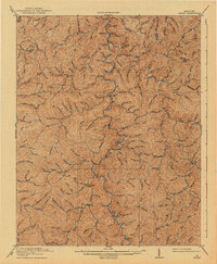
1919 Map of Hyden
USGS Topo · Published 1919About this map
The Middle Fork Kentucky River carves a winding path through the center of this 1919 survey, serving as the primary geographic corridor for Leslie County. The settlement of Hyden stands as a central hub, surrounded by a dense network of creek-side communities such as Dryhill, Hoskinson, and Wooton. The nomenclature of the landscape reflects a vivid local history, with descriptive watercourses like Hell for Certain Creek and Greasy Creek defining the narrow valleys. This period was characterized by small-scale mountain settlements, with places like Asher and Chappell appearing as vital points of connection along the numerous branches and forks. The map also delineates the high ridges that form the Boundary Line between Leslie, Perry, and Clay counties, illustrating the isolation and specific drainage patterns that dictated the early growth of these Appalachian communities.
Find a feature on this map
98 named features on this map. Tap any name to fly to it.
Don’t see what you’re looking for? This feature index may not catch every label — zoom into the map to look around manually.
Map Details
Editions of this 1919 Hyden Map
2 editions found
Other maps of this area

1886 · Cumberland Gap
USGS Topo · 1:125,000

1887 · Jonesville
USGS Topo · 1:125,000

1888 · Cumberland Gap
USGS Topo · 1:125,000

1891 · Manchester
USGS Topo · 1:125,000

1891 · Cumberland Gap
USGS Topo · 1:125,000

1891 · Hazard
USGS Topo · 1:125,000

1891 · Jonesville
USGS Topo · 1:125,000

1903 · Harlan
USGS Topo · 1:48,000

1903 · Pineville
USGS Topo · 1:48,000

1913 · Buckhorn
USGS Topo · 1:62,500