1903 Map of Pineville
USGS Topo · Published 1903About this map
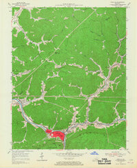
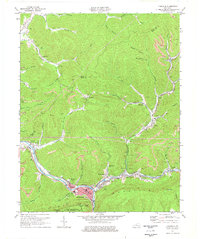
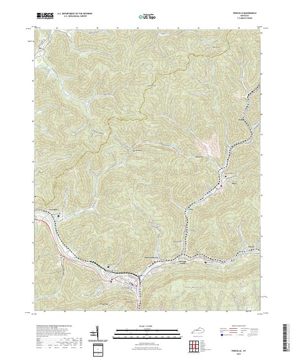
Cumberland Mountain dominates this 1903 topographical study, showing the dramatic rise of the terrain in Bell County at the turn of the century. The map captures the natural gateway formed where the Cumberland River cuts through the ridges, a vital corridor for early Kentucky settlement and transport. Surveyed by Nat Tyler, Jr. and R. W. Berry under the direction of Charles D. Walcott, the sheet focus is primarily on the physical geography of the ridge and its drainage patterns, such as Puckett Creek. This record illustrates the elevation and landforms of the region before significant industrial development altered the local topography, providing a baseline for researchers interested in the natural state of the Pineville area during the early twentieth century.
Find a feature on this map
3 named features on this map. Tap any name to fly to it.
Don’t see what you’re looking for? This feature index may not catch every label — zoom into the map to look around manually.
Map Details
Editions of this 1903 Pineville Map
This is the sole edition of this map. No revisions or reprints were ever made.
Historical Maps of Pineville Through Time
8 maps found