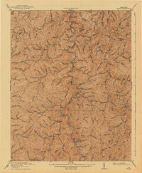
1919 Map of Hyden
USGS Topo · Published 1941About this map
Hyden serves as the central hub of this 1916 survey, situated at the confluence of the Middle Fork Kentucky River and Rockhouse Creek. The landscape is defined by an intricate network of waterways and hollows, where small settlements like Hoskinson, Asher, and Dryhill follow the narrow valleys of Greasy Creek and Cutshin Creek. The map documents the complex topography of the Cumberland Plateau before modern infrastructure, showing the critical role of river forks and mountain branches in shaping the early 20th-century settlement patterns of Leslie County.
Find a feature on this map
112 named features on this map. Tap any name to fly to it.
Don’t see what you’re looking for? This feature index may not catch every label — zoom into the map to look around manually.
Map Details
Editions of this 1919 Hyden Map
2 editions found

Other maps of this area

1886 · Cumberland Gap
USGS Topo · 1:125,000

1887 · Jonesville
USGS Topo · 1:125,000

1888 · Cumberland Gap
USGS Topo · 1:125,000

1891 · Manchester
USGS Topo · 1:125,000

1891 · Cumberland Gap
USGS Topo · 1:125,000

1891 · Hazard
USGS Topo · 1:125,000

1891 · Jonesville
USGS Topo · 1:125,000

1903 · Harlan
USGS Topo · 1:48,000

1903 · Pineville
USGS Topo · 1:48,000

1913 · Buckhorn
USGS Topo · 1:62,500