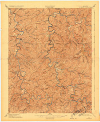
1913 Map of Buckhorn
USGS Topo · Published 1932About this map
Witherspoon College stands as a notable center of learning within this 1911 survey of the Kentucky mountains, situated near the winding Middle Fork Kentucky River. The landscape is defined by the complex drainage patterns of Troublesome Creek and Buck Creek, where small settlements like Crockettsville and Buckhorn served as focal points for rural life. The presence of the Breathitt Ferry near the boundary line of Breathitt and Perry counties highlights the importance of river crossings before modern bridge infrastructure dominated the region. Numerous schools, including Wilder School and Otter Creek School, are scattered across the narrow valleys, illustrating the decentralized nature of early 20th-century mountain education. Distinctive terrain features such as Nailors Rock, Elkbutt Knob, and the Fishtrap Shoals provide a grounded look at the landmarks used by local inhabitants to navigate this intricate river-and-ridge topography.
Find a feature on this map
61 named features on this map. Tap any name to fly to it.
Don’t see what you’re looking for? This feature index may not catch every label — zoom into the map to look around manually.
Map Details
Editions of this 1913 Buckhorn Map
2 editions found
Other maps of this area

1889 · Salyersville
USGS Topo · 1:125,000

1891 · Manchester
USGS Topo · 1:125,000

1891 · Hazard
USGS Topo · 1:125,000

1891 · Salyersville
USGS Topo · 1:125,000

1892 · Beattyville
USGS Topo · 1:125,000

1899 · Salyersville
USGS Topo · 1:125,000

1913 · Buckhorn
USGS Topo · 1:62,500

1914 · Troublesome
USGS Topo · 1:62,500

1916 · Cornettsville
USGS Topo · 1:62,500

1916 · Hyden
USGS Topo · 1:48,000