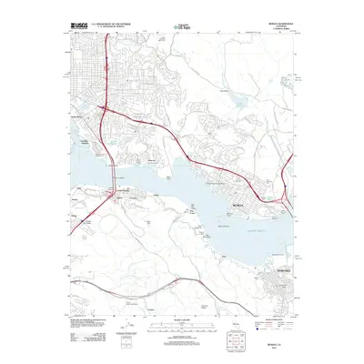
2012 Map of Benicia
USGS Topo · Published 2012About this map
Benicia and Martinez face each other across the narrows where the waters of the Pacific Ocean meet the interior river systems, creating a dense network of maritime and industrial infrastructure. The 2012 landscape is defined by its deep-water access, featuring the Port of Benicia, Martinez Yacht Harbor, and the Nevada Dock. These ports are complemented by a significant concentration of historical burial grounds, including the Military Cem, Benicia City Cem, and Saint Dominics Cem, which offer significant value for genealogical research in Solano and Contra Costa counties.
Find a feature on this map
116 named features on this map. Tap any name to fly to it.
Don’t see what you’re looking for? This feature index may not catch every label — zoom into the map to look around manually.
Map Details
Editions of this 2012 Benicia Map
This is the sole edition of this map. No revisions or reprints were ever made.
Other maps of this area

1895 · San Francisco
USGS Topo · 1:62,500

1896 · Carquinez Strait
USGS Topo · 1:62,500

1897 · Concord
USGS Topo · 1:62,500

1898 · Karquines
USGS Topo · 1:62,500

1899 · San Francisco
USGS Topo · 1:62,500

1901 · Karquines
USGS Topo · 1:62,500

1902 · Napa
USGS Topo · 1:125,000

1915 · Concord
USGS Topo · 1:62,500

1915 · San Francisco
USGS Topo · 1:62,500

1916 · Mare Island
USGS Topo · 1:62,500